
CHCNAVMeasurement Terminal
AU20 Mobile Measurement System
Model:AU20
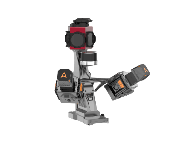
The HuaCe AU20 Mobile Mapping System is a high-precision, versatile, and highly intelligent vehicle-based mobile mapping solution. Its upgraded laser sensors deliver finer detail in capturing ground features. The new-generation vehicle platform supports multiple sensor types, vastly expanding application possibilities. Powered by AI algorithms, it enables intelligent data preprocessing, doubling office efficiency. This system is widely used in highway surveying, road asset management, highway expansion and reconstruction, and as-built road surveys.
Highlights
Key Features
200K points/sec ultra-high frequency
5mm distance accuracy / 3mm repeatability
250-meter extended-range operation
AP7 Vehicle Platform Dual-LiDAR Mount
AI-powered data preprocessing
360° Panoramic Scan
Specifications
Technical Specifications
Supply Voltage
24V (wide voltage range 20-27V)
Data Storage
Unified Storage 2TB
Operating Temperature
-20℃~+50℃
Typical Power
150W
IP Rating
IP64
Laser Safety Class
Class1 (Eye Safe)
Size
262.3*141.5*161mm
Weight
2.82kg
Distance Range
1.5~250m (Vehicle Mode) / 1.5~1500m (Aircraft Mode)
Maximum Emission Point Frequency
200 points/sec
Max Line Speed
200 lines/sec
Distance Accuracy / Repeatability
5mm/3mm
Field of View
360°
Echo signal
16 times
Multi-period
7 times
GNSS
GPS:L1,L2,L5 / GLONASS:L1,L2 / BEIDOU:B1,B2,B3 / GALILEO:E1,E5a,E5b
Post-processing attitude accuracy
Roll/Pitch: 0.005° / Heading: 0.010°
Post-processing position accuracy
Level: 0.010m / Elevation: 0.020m
Data update frequency
600 Hz
Vehicle Kit Model
AP7 Single-Head / AP7 Dual-Head
Car Kit Dimensions
528*301*638mm / 505*604*609mm
Vehicle Kit Weight
7 5kg / 8.3kg( (no radar & camera)
Imaging System
Ladybug5+ 3000K / Ladybug6 7200K
Maximum SLAM range
120m
SLAM module point frequency
32 points/sec
YesAU20 Mobile Measurement SystemInterested?
Contact us for product quotes and technical solutions