

HCT Handheld
Handheld Surveying Instruments
Huace Navigation professional handheld surveying equipment, integrating SLAM and high-precision RTK technology to deliver accurate and efficient 3D measurement solutions for land surveying, smart cities, BIM construction, agricultural and forestry measurements, and underground space data collection.
Core Product Advantages
Core Advantages
Centimeter-level accuracy
RTK Real-Time Kinematic positioning with centimeter-level accuracy
SLAM Fusion
Deep Fusion of SLAM and High-Precision RTK
Extended Battery Life
Large-capacity battery with up to 4 hours of battery life
Industrial Protection
IP54 rated for harsh environments
MMS Mobile Measurement System
Mobile Mapping System
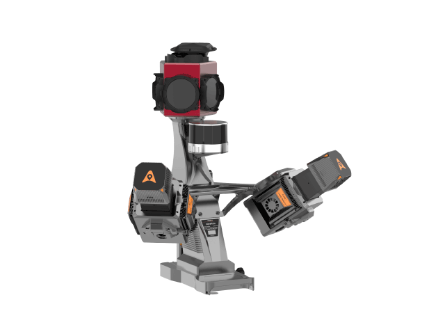
AU20 Mobile Measurement System
Model:AU20
The HuaCe AU20 Mobile Mapping System is a high-precision, versatile, and highly intelligent vehicle-based mobile mapping solution. Its upgraded laser sensors deliver finer detail in capturing ground features. The new-generation vehicle platform supports multiple sensor types, vastly expanding application possibilities. Powered by AI algorithms, it enables intelligent data preprocessing, doubling office efficiency. This system is widely used in highway surveying, road asset management, highway expansion and reconstruction, and as-built road surveys.
Use Cases
Application Scenarios
Land Surveying and Mapping
Topographic surveying, cadastral surveying, and control surveying
Smart City
Urban 3D Modeling, BIM Construction
Agricultural and Forestry Surveying
Forestry resource survey, precision agricultural measurement
Underground Space
Underground utility tunnels, mine shafts, and tunnel surveying
Precision measurement, efficient operations
HuaCe Navigation handheld surveying devices integrate SLAM and high-precision RTK technology to deliver centimeter-level positioning solutions for land surveying, smart cities, and BIM construction.