Huayingtech ·Surveying and Geomatics
Surveying, Mapping and Geographic InformationIndustry Solutions
End-to-end workflow from field data collection to database integration
The core competitiveness of surveying projects lies in result accuracy and delivery efficiency. We combine UAVs, RTK, 3D scanning, and unmanned boats based on survey area types, paired with modeling and mapping software to create reusable workflows.
3 Class
Air / Ground / Water
cm-level
RTK nominal positioning accuracy range
1 sets
Field-to-Deliverables Workflow Standards
Industry Challenges
- · Significant variation in survey area types makes it difficult for a single device to cover mountainous, urban, and aquatic regions.
- · Deliverables do not match the client's requirements, resulting in excessive rework.
- · Tight project timeline risks disconnection between field and office work.
Solution Composition
Proposal01 · One flight, multiple deliverables.
Real-world 3D and Oblique Photography
A five-lens oblique camera mounted on a multi-rotor platform captures images from multiple angles. Aerial triangulation generates real-world 3D models and orthophotos, with optional output of DSMs and individual building models.
Use Cases:Urban real-scene 3D modeling, campus modeling, and as-built surveying
Products involved:Seer Survey Scanning & Aerial Cameras, DJI Enterprise Drones, Surveying & Modeling Software, FusionServer
Deliverables:Aerial Photography Plan, Ground Control Point Layout, Block Adjustment and Model Outputs, Accuracy Verification Report, and Modeling Computing Resource Configuration
Proposal02 · Control, Layout, and As-Built in One Line
High-Precision Engineering Surveying
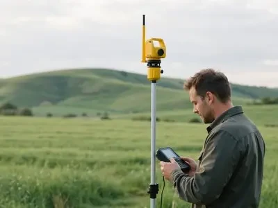
RTK and total stations complete control surveying and construction staking; 3D scanners capture existing structural surfaces. Results are directly importable into design software for clash detection.
Use Cases:Municipal and Road Engineering, Factory and Equipment Installation, Existing Building Renovation
Products involved:HuaCe handheld surveying, Seer scanning and aerial photography cameras, surveying and modeling software, HuaCe UAVs
Deliverables:Control network layout, stakeout data preparation, point cloud and model deliverables, as-built survey report
Proposal03 · Surface navigation, underwater imaging
Water and Underwater Surveying
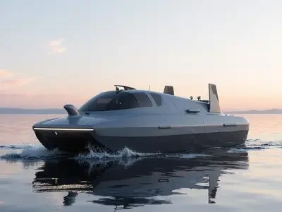
Autonomous surface vessels equipped with depth sounders and positioning systems collect underwater topography data, while underwater robots perform close-range inspections of key areas. The collected data is integrated with shoreline data to generate a complete survey map.
Use Cases:Inspection of reservoirs and lakes, ports and waterways, bridge piers, and sluice gates
Products involved:Huace Unmanned Surface Vehicles, Subsea Underwater Robots, Huace Handheld Surveying Equipment, and Mapping & Modeling Software
Deliverables:Survey Area and Flight Line Division, Equipment Calibration, Underwater Topography Results, Technical Summary Report
Support & Services
Survey Area Reconnaissance and Scheme Design · Equipment Configuration and Calibration · Deliverable Quality Inspection · Personnel Training
Huaying Technology Co., Ltd. · Enterprise Hardware & Security Solutions Provider
Main Line 010-8298-1888 · Customer Service 400-606-8166 · Building 7, No. 2 Guanghua Road, Chaoyang District, Beijing
Specifications and configurations in this brochure are subject to the selection list and final contract. Please consult sales for pricing.